 Catalogue PIGMA
/Activités et Usages/Analyse économique et sociale
Type of resources
Available actions
Topics
Keywords
Contact for the resource
Provided by
Years
Formats
Representation types
Update frequencies
status
Scale
Resolution
-
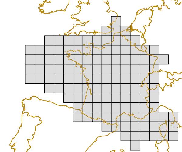
The grid is based on proposal at the 1st European Workshop on Reference Grids in 2003 and later INSPIRE geographical grid systems. The sample grid available here is part of a set of three polygon grids in 1, 10 and 100 kilometres. The grids cover at least country borders and, where applicable, marine Exclusive Economic Zones v7.0, http://www.marineregions.org. Note that the extent of the grid into the marine area does not reflect the extent of the territorial waters.
-
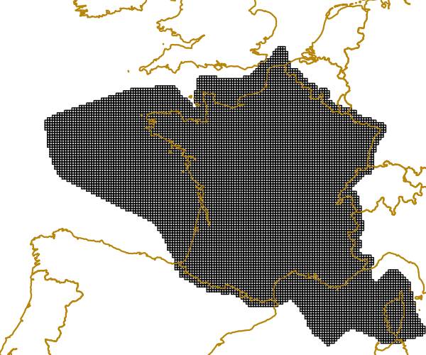
The grid is based on proposal at the 1st European Workshop on Reference Grids in 2003 and later INSPIRE geographical grid systems. The sample grid available here is part of a set of three polygon grids in 1, 10 and 100 kilometres. The grids cover at least country borders and, where applicable, marine Exclusive Economic Zones v7.0, http://www.marineregions.org. Note that the extent of the grid into the marine area does not reflect the extent of the territorial waters.
-
Complete Coastline Features for all the countries that produced Corine Land Cover 2000 and have a coastline, with detailed descriptions on the environment and type of coastal areas. Each coast segment has inherited CLC 2000 class, and also the attributes from Eurosion Coastline version 2.1 2004, regarding geomorphology, type of coast and erosion trends.
-
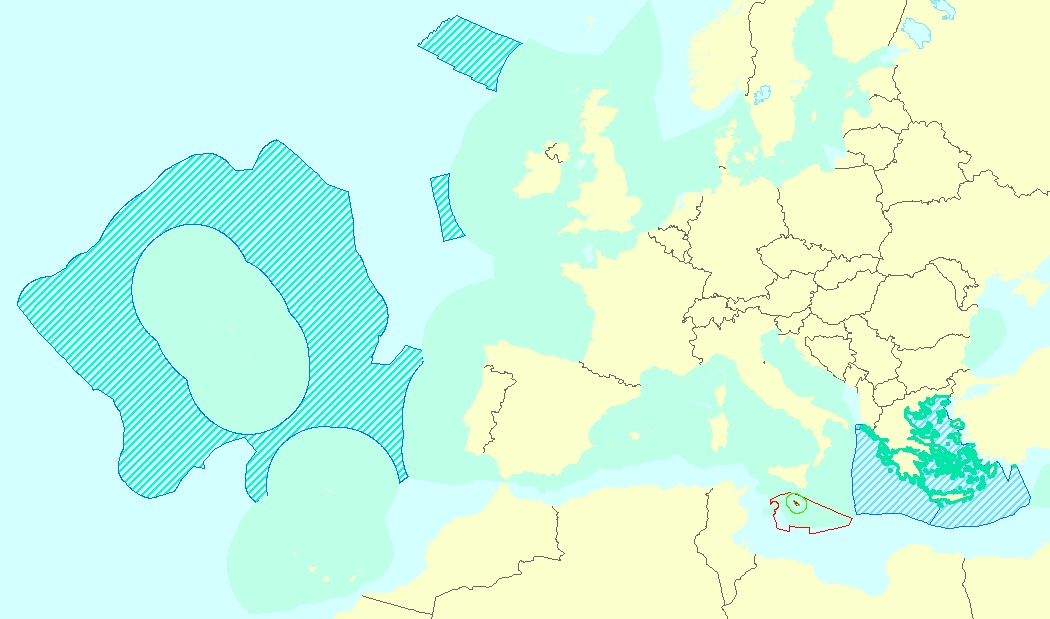
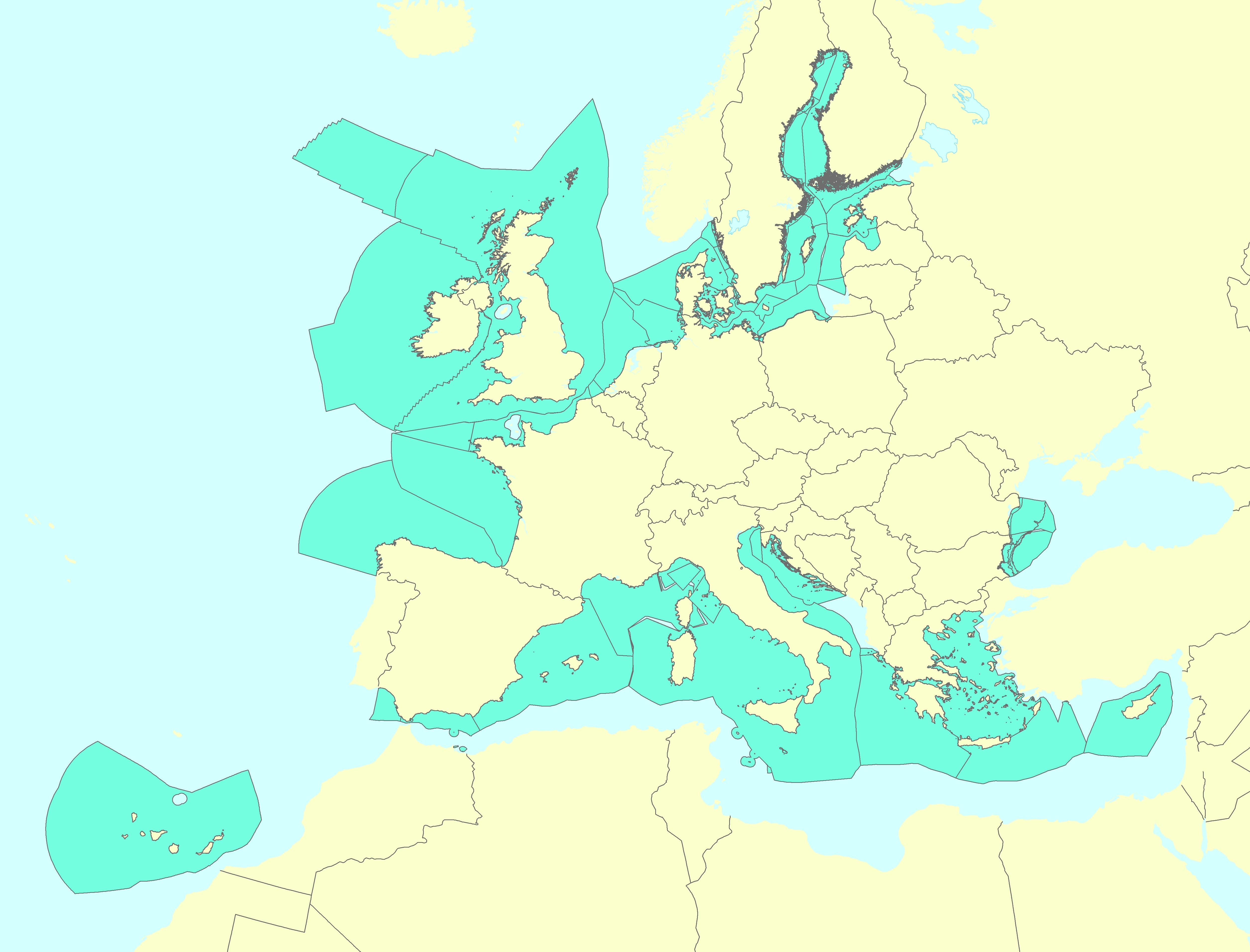
This vector data set is the first public version released of the EU marine waters used for the implementation of the Marine Strategy Framework Directive (MSFD), submitted by the Member States to the European Commission. The Marine Strategy Framework Directive (MSFD) applies to all marine waters of EU Member States, which in Article 3 are defined as follows: (a) waters, the seabed and subsoil on the seaward side of the baseline from which the extent of territorial waters is measured extending to the outmost reach of the area where a Member State has and/or exercises jurisdictional rights, in accordance with the UNCLOS, with the exception of waters adjacent to the countries and territories mentioned in Annex II to the Treaty and the French Overseas Departments and Collectivities; and (b) coastal waters as defined by Directive 2000/60/EC, their seabed and their subsoil, in so far as particular aspects of the environmental status of the marine environment are not already addressed through that Directive or other Community legislation.
-
The Marine Reporting Units (MRUs) are used within the reporting obligations of the Marine Strategy Framework Directive (MSFD) in order to link the implementation of the different articles to specific marine areas. The MRUs can be of varying sizes, according to the appropriate scale for the different reports (e.g. region, sub-region, regional or sub-regional subdivision, Member State marine waters, WFD coastal waters, etc.), as indicated in the Good Environmental Status 2017 Decision. The present data set is the first public version released of the MRUs used during the first cycle of implementation of the MSFD (2012-2018) in all the reporting exercises (2012 reporting of Articles 8, 9 and 10; 2014 reporting of Article 11; and 2016 reporting of Articles 13 & 14). The data set is distributed in SHP and in INSPIRE-compliant GML format.
-

The Coastal Zones (CZ) LC/LU product for 2018 is providing a detailed Land Cover / Land Use (LC/ LU) dataset for areas along the coastline of the EEA38 countries and the United Kingdom, with reference year 2018 for the classification. This product monitors landscape dynamics in European coastal territory to an inland depth of 10 km with a total area of approximately 730,000 km², with all the relevant areas (estuaries, coastal lowlands, nature reserves). The production of the coastal zone layers was coordinated by the European Environment Agency (EEA) in the frame of the EU Copernicus programme, as part of the Copernicus Land Monitoring Service (CLMS) Local Component. The Coastal Zones product covers a buffer zone of coastline derived from EU-Hydro v1.1. Land Cover/Land Use (LC/LU) layer is extracted from Very High Resolution (VHR) satellite data and other available data. The class definitions follow the pre-defined nomenclature on the basis of Mapping and Assessment of Ecosystems and their Services (MAES) typology of ecosystems (Level 1 to Level 4) and CORINE Land Cover adapted to the specific characteristics of coastal zones. The classification provides 71 distinct thematic classes with a Minimum Mapping Unit (MMU) of 0.5 ha and a Minimum Mapping Width (MMW) of 10 m. The product is available for the 2012 and 2018 reference year including change mapping. This CZ dataset is distributed in vector format, in a single OGC GeoPackage SQLite file covering the area of interest. You can read more about the product here: https://land.copernicus.eu/en/products/coastal-zones/coastal-zones-2018.
-
The Coastal Zones (CZ) LC/LU product for 2012 is providing a detailed Land Cover / Land Use (LC/ LU) dataset for areas along the coastline of the EEA38 countries and the United Kingdom, with reference year 2012 for the classification. This product monitors landscape dynamics in European coastal territory to an inland depth of 10 km with a total area of approximately 730,000 km², with all the relevant areas (estuaries, coastal lowlands, nature reserves). The production of the coastal zone layers was coordinated by the European Environment Agency (EEA) in the frame of the EU Copernicus programme, as part of the Copernicus Land Monitoring Service (CLMS) Local Component. The Coastal Zones product covers a buffer zone of coastline derived from EU-Hydro v1.1. Land Cover/Land Use (LC/LU) layer is extracted from Very High Resolution (VHR) satellite data and other available data. The class definitions follow the pre-defined nomenclature on the basis of Mapping and Assessment of Ecosystems and their Services (MAES) typology of ecosystems (Level 1 to Level 4) and CORINE Land Cover adapted to the specific characteristics of coastal zones. The classification provides 71 distinct thematic classes with a Minimum Mapping Unit (MMU) of 0.5 ha and a Minimum Mapping Width (MMW) of 10 m. The product is available for the 2012 and 2018 reference year including change mapping. This CZ dataset is distributed in vector format, in a single OGC GeoPackage SQLite file covering the area of interest. You can read more about the product here: https://land.copernicus.eu/en/products/coastal-zones/coastal-zones-2012.
-

The Coastal Zones LC/LU Change (CZC) 2012-2018 is providing the Land Cover / Land Use (LC/ LU) change for areas along the coastline of the EEA38 countries and the United Kingdom, between the reference years 2012 and 2018. The Coastal Zones product monitors landscape dynamics in European coastal territory to an inland depth of 10 km with a total area of approximately 730,000 km², with all the relevant areas (estuaries, coastal lowlands, nature reserves). The production of the coastal zone layers was coordinated by the European Environment Agency (EEA) in the frame of the EU Copernicus programme, as part of the Copernicus Land Monitoring Service (CLMS) Local Component. The Coastal Zones Change product covers a buffer zone of coastline derived from EU-Hydro v1.1. The Land Cover/Land Use (LC/LU) Change layer is extracted from Very High Resolution (VHR) satellite data and other available data. The reference years for the change are 2012 and 2018. The class definitions follow the pre-defined nomenclature on the basis of Mapping and Assessment of Ecosystems and their Services (MAES) typology of ecosystems (Level 1 to Level 4) and CORINE Land Cover adapted to the specific characteristics of coastal zones. The classification provides 71 distinct thematic classes with a Minimum Mapping Unit (MMU) of 0.5 ha and a Minimum Mapping Width (MMW) of 10 m. The status product is available for the 2012 and 2018 reference years. This CZC dataset is distributed in vector format, in a single OGC GeoPackage file covering the area of interest. You can read more about the product here: https://land.copernicus.eu/en/products/coastal-zones/coastal-zones-change-2012-2018.
-

Le rapport dresse un tableau de l’état de la flotte immatriculée sous les différents registres français de flotte de commerce au 1er janvier 2021 : catégories de navire, âge de la flotte, etc.
-
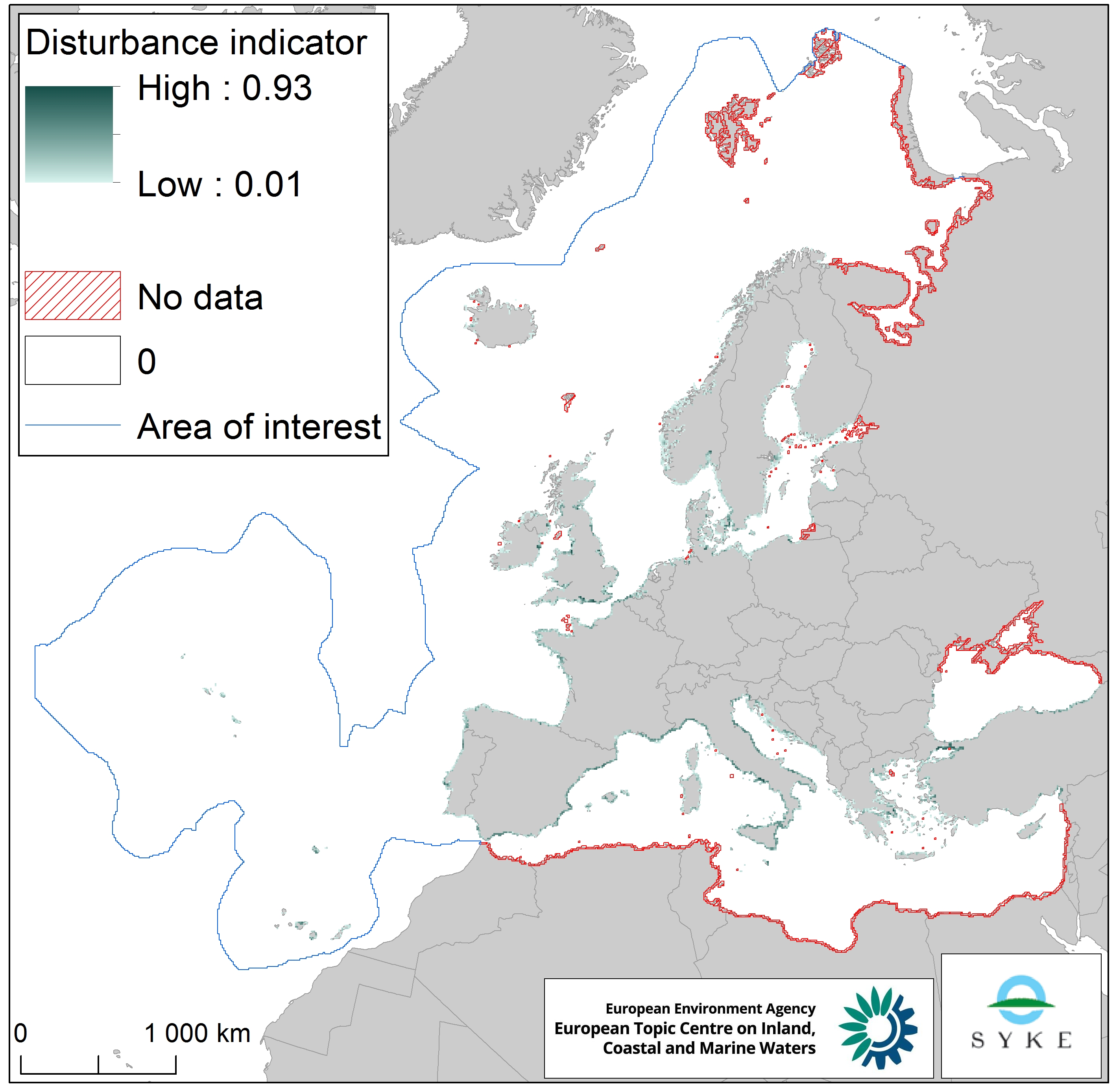
The raster dataset represents the intensity of species disturbance due to human presence along European coastlines. The dataset was created by combining the coastal urbanisation layer derived from Corine Land Cover 2012 (with the percentage of urbanised coastline per EEA 10 km grid cell) and the population density layer based on EUROSTAT NUTS 2016 data (with the population density in the NUTS 3 region corresponding to the coastal EEA 10 km grid cell). The dataset does not cover southern and western Mediterranean Sea, northern Black Sea and northernmost Atlantic Ocean. The dataset was prepared for the combined effect index produced for the ETC/ICM Report 4/2019 "Multiple pressures and their combined effects in Europe's seas" available on: https://www.eionet.europa.eu/etcs/etc-icm/etc-icm-report-4-2019-multiple-pressures-and-their-combined-effects-in-europes-seas-1.